|
The Incline
San Francisco has it's cable cars, and Pittsburgh
has it's incline. Both had their picturesque beginnings as practical transportation
systems, which took advantage of the local hills; both were to become something
far greater. These icons of their respective cities are, in both cases,
run by a system of cables, and counterweights. Such systems could not be
made to work on a level plane; but are well suited to use on grades which
confound more conventional transit systems. It is perhaps coincidental that
the types of terrain, which lend themselves to these cable powered transit
systems, are also strikingly pleasing to the eye.
Of the original fifteen or so inclines, two still operate
today. Both operate on Mount Washington, which had formerly been known as
Coal Hill. Amazingly, the two remaining inclines are the two oldest. All
of the inclines served the city well, as part of it's transportation system,
until the mid fifties. Their decline came about due to the blasting of tunnels,
the increased power of the automobile, and the increasing integration, by
roads, of the surrounding hills with the center of town. Where once the
inclines filled with workers from their homes in the surrounding hills,
bringing them down to the mills, offices, and docks of the heart of the
city, today they come by car, bus, and light rail.
|
|
|
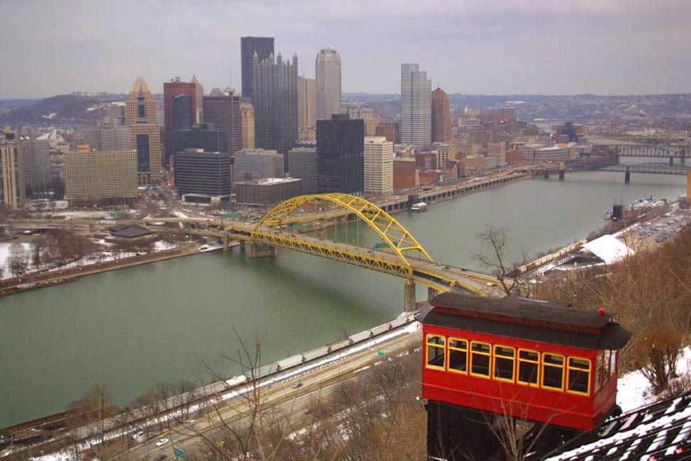
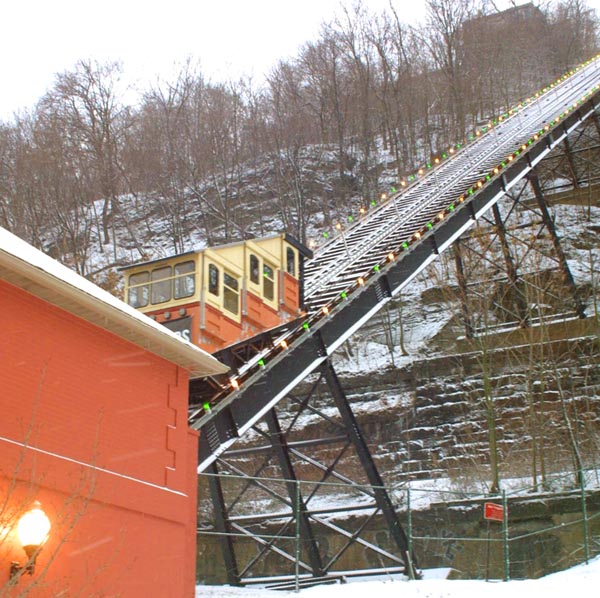
The Monongahela Incline (built in 1870)
is located near the Smithfield Street bridge, directly across the Monongahela
River from downtown Pittsburgh. It has a length of 635 feet (193.5 m),
a height of 367.4 feet (112 m), and a grade of 78% (38 degrees). Its lower
station is across the street from the Station Square shopping complex,
and is easily accessible from the light rail system at the Station Square
station. It is operated by the Port Authority of Allegheny County, which
operates the rest of Pittsburgh's transit system. Transfers can be made between
the incline and the light rail and buses.
|
|
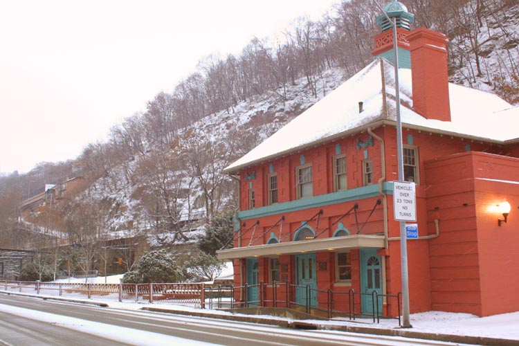
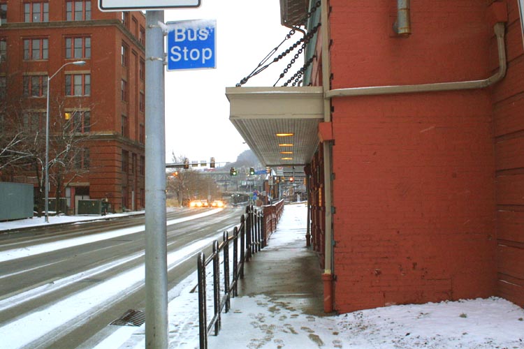
The Incline is connected to the rest of
the Pittsburgh transit system. In addition to the bus stop right outside
of the door, a platform for the light rail system is just up the block.
Though the Incline is now mostly a tourist attraction, it was for a time
an integral part of the local transportation network, and was indespensable
for getting the people from the hills into the center of the city.
|
|
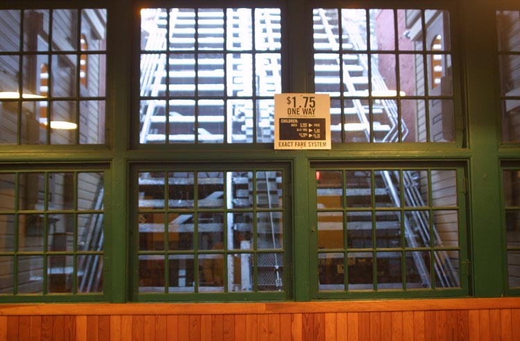
A view of the tracks, with no car in the
station. fare is teh same as that for the bus or light rail system. This
incline is run by the Port Authority, which also runs the integrated transit
system. Transfers are available here, and the Incline accepts transfers
from the transit system.
|
|
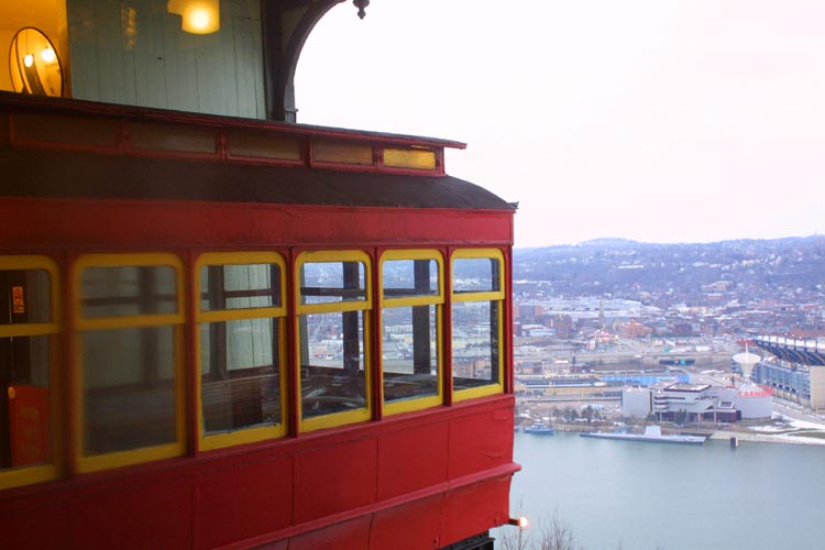
The odd looking triple level car of the Monongahela
Incline, as it starts up the side of Mount Washington. The cars are set
to go every three minutes.
|
|
A look down at the lower station, as the
car heads up the mountain.
|
|
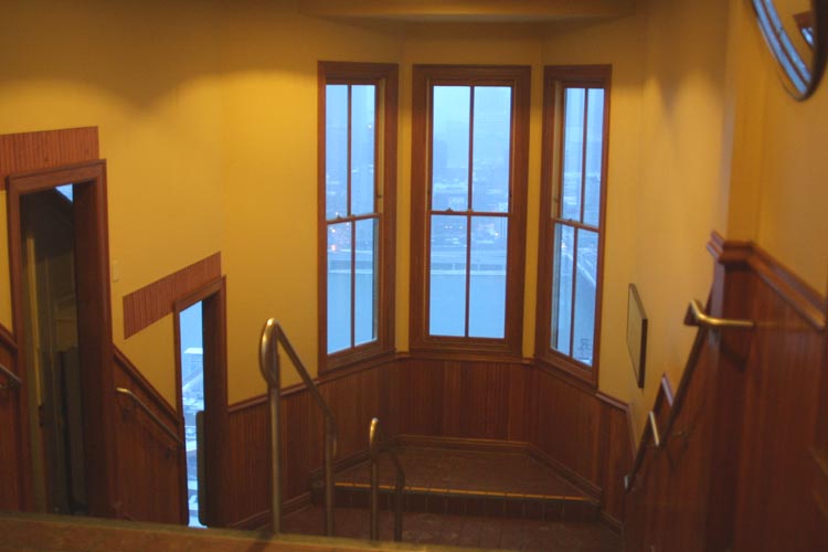
A look down from the top. Across the street
at the bottom is the Station Square shopping mall, just across the Monongahela
river from downtown.
|
|
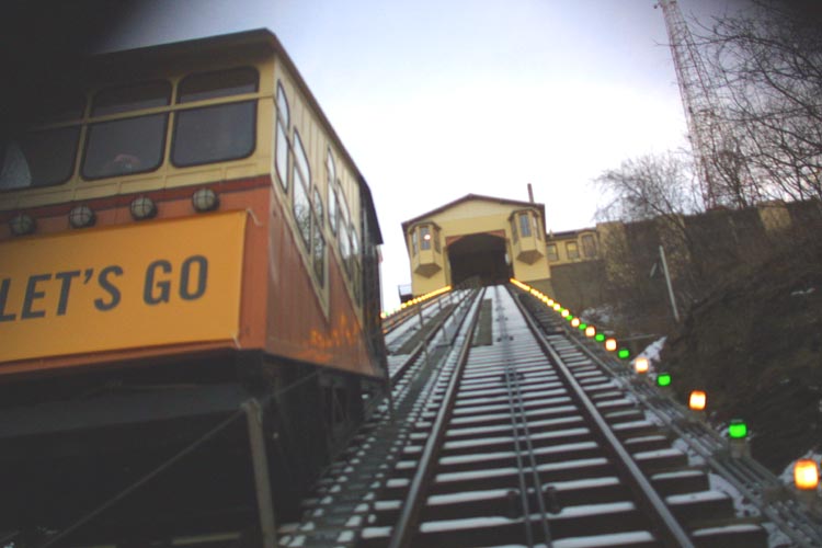
A view of my car, as it heads down the Incline
without me.
|
|
A look at the car, as it awaits departure
from the upper station. Cars leave every three minutes.
|
|
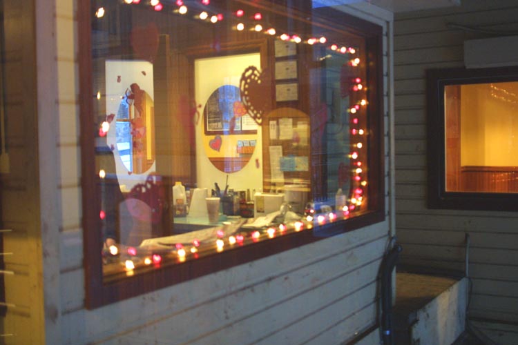
My visit coincided with Valentine’ s Day,
and the control station of the incline was lit up appropriately.
|
|
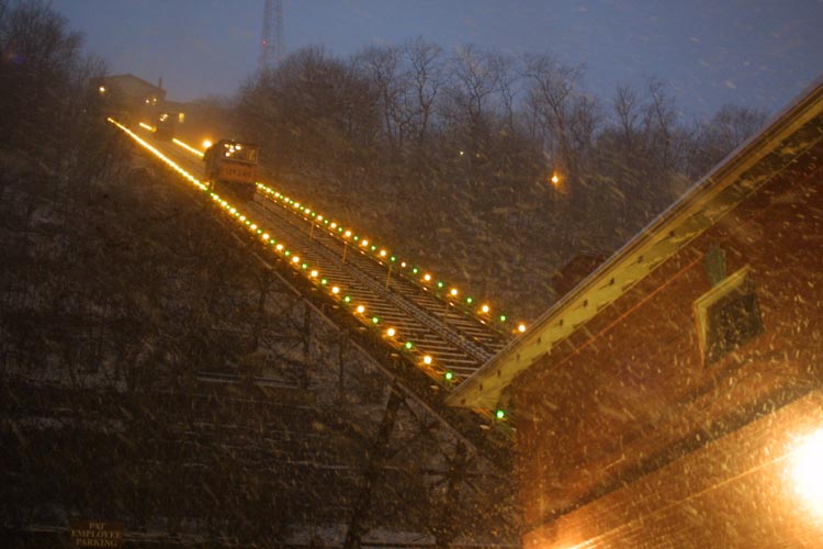
A look towards the top during a snow storm.
The cars run until after midnight, every day of the week.
|
|
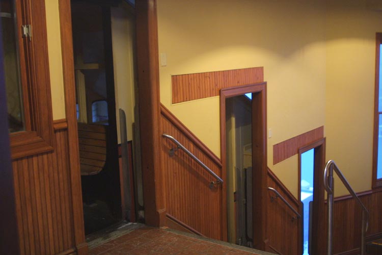
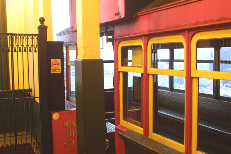
A look towards the door to the car, as I wait
at the upper station. The doors are open, and a glimpse outside is available
through the bottom door. The doors are at three levels, and each level
of the car is entered through it's own door.
|
|
At the bottom of the loading plaform is an
observation window to the river below, and the town across.
|
|
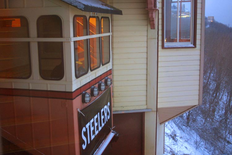
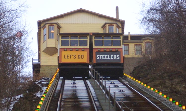
The Steelers had recently won the championship.
Pittsburgh was just a bit enthusiastic about this.
|
|
A look at the other car, as we pass.
|
|
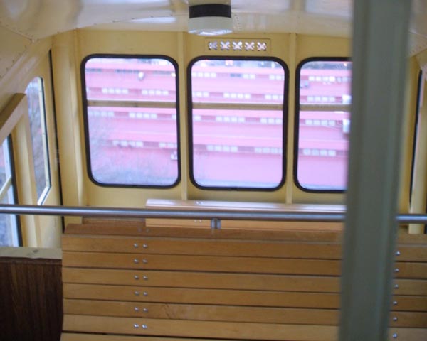
This is a view down the car, from the uppermost
of it’s three levels. This is on the Monongahela Incline.
|
|
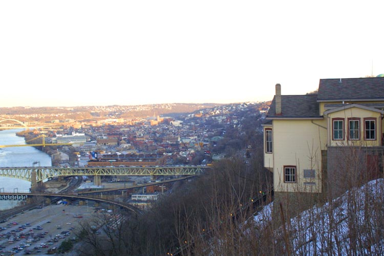
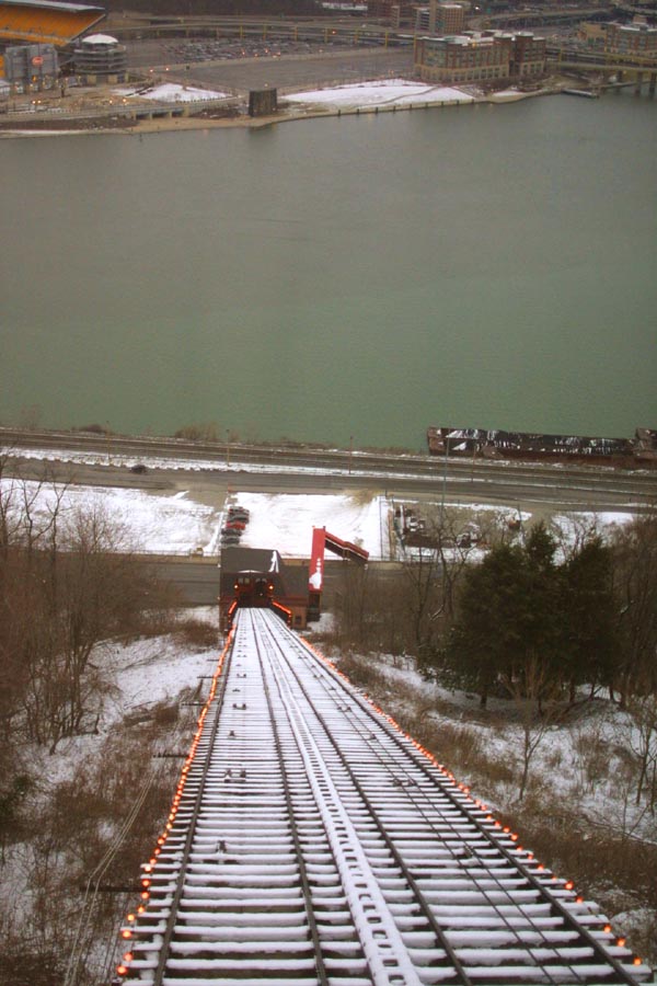
A look down the valley, from the rim of one
of the surrounding mountains. The Incline station hovers over the edge like
a Swiss chalet.
|
|
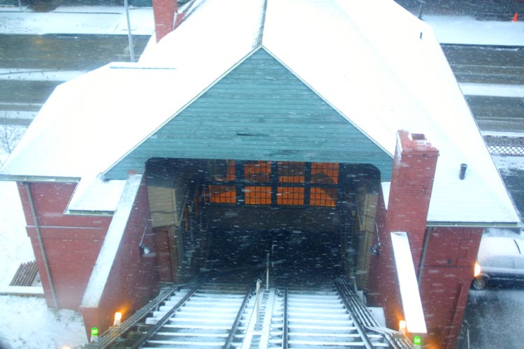
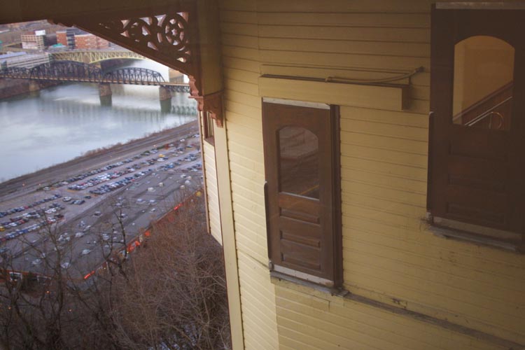
A look down from the enclosed terminal. Parking,
old rail yards, and the river are visible below.
|
|
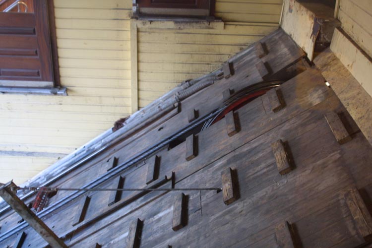
This is the top of the incline; The cables
can be seen emerging from the platform. The wooden blocks are footholds for
maintenance crews.
|
|
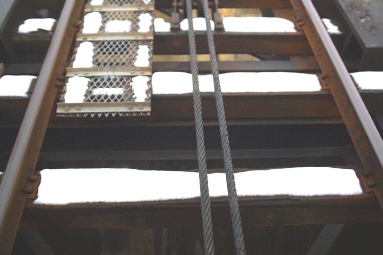
A look at the cable running between the tracks
of the incline.
|
|
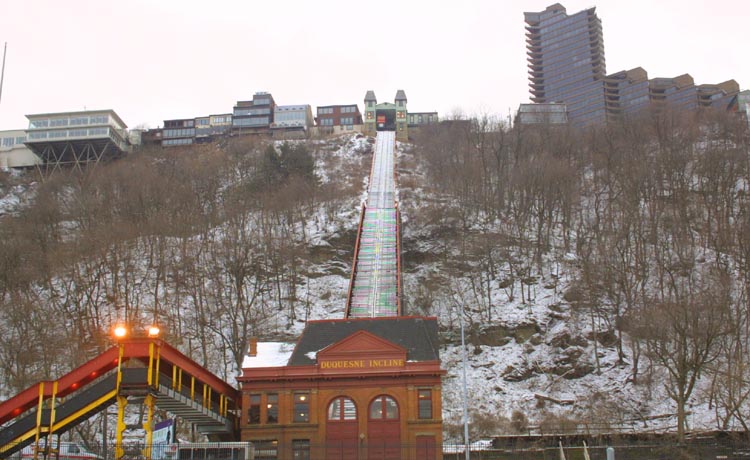
The Duquesne Incline (built in 1877) is
located just west of the Fort Pitt Bridge, and faces the Ohio River.
it has a length of 793 feet (242 m), a height of 400 feet (122 m), and
a grade of 58% (30 degrees). Its lower station is served by buses on West
Carson Street; it is also possible, although perhaps not very pleasant,
to walk across the Fort Pitt Bridge from downtown. It is operated by a non-profit
preservation society, but transfers can be made to and from Port Authority
Transit buses at both stations.
|
|
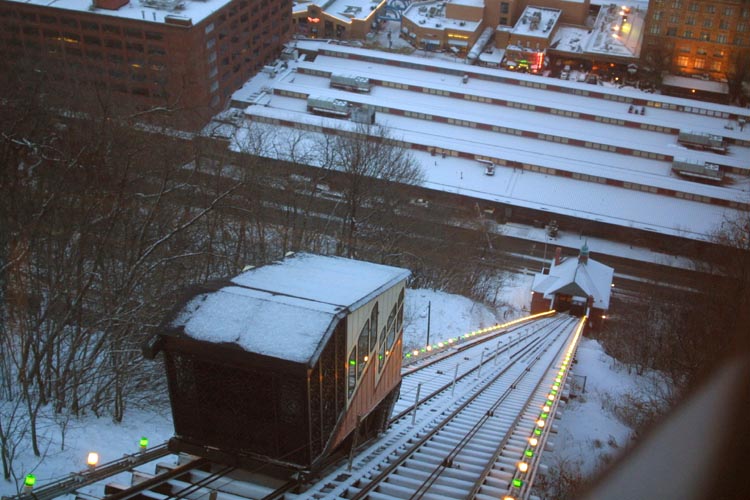
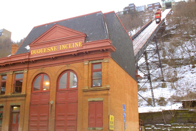
The lower station of the Duquesne Incline,
with it’s cars running in the background.
|
|
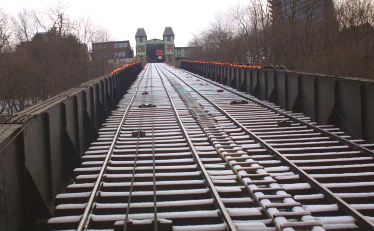
A look up the track to the upper station.
The old terminal looks a bit like an old fashioned haunted house.
|
|
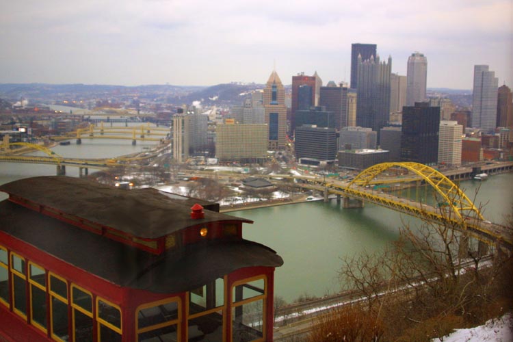
A view of the city, and it’s rivers, from
the top of the Duquesne.
|
|
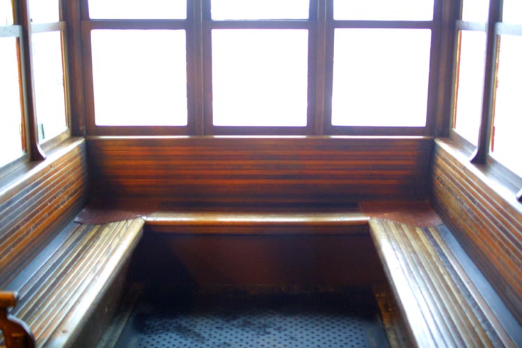
The inside of one of the old Duquesne cars.
These are the original cars from the nineteenth century.
|
|
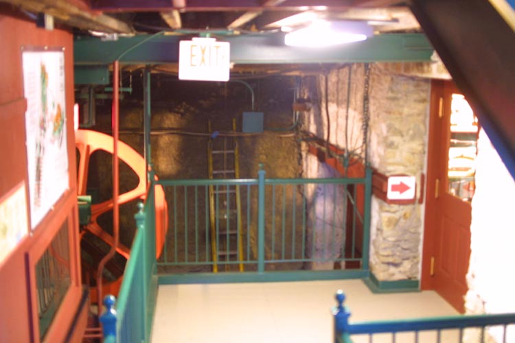
For a bit of change, you may gain access
to the machinery rooms, in the heart of the upper station. This bit of restored
nineteenth century high tech is fascinating to see.
|
|
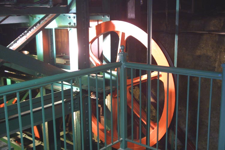
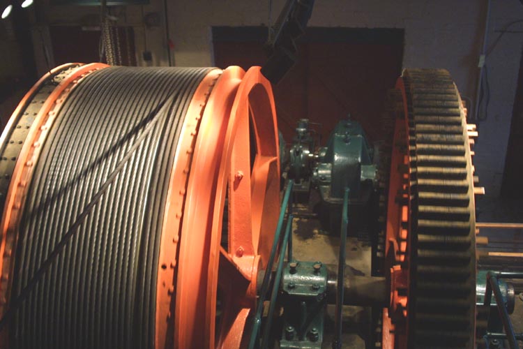
The big pulley wheel, on which the incline
runs. This huge casting bears the weight of both cars, and moderates the
ride a bit.
|
|
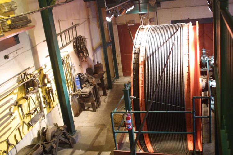
The drum, on which the cable is wound and
unwound. Just to the right, and behind the drum, may be seen the motor which
provides the power. Note the small size of the motor. As with the cable
cars of SanFrancisco, the funiculars of Pittsburgh balance their weight
against each other, requiring only a small motor to make up for any current
difference in weight between them.
|
|
A close up of the drum, along with the cogwheel
and motor, which drive it.
|
|
One of the cars of the Duquesne Incline,
hanging in the upper station, and awaiting boarders. These cars were built
by a trolley company, and were based upon trolley car designs.
|
|
The entry gate at the upper station of the
Duquesne. Riding these cars is a bit like taking a trip back in time, except
for the magnificent skyline visible outside of the windows.
|
|
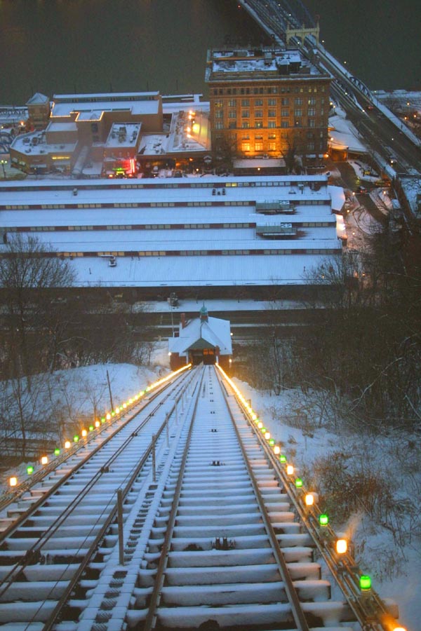
A look down the Duquesne Incline, to the
rail yard below. Though this area is not as busy as the Station square area
near the Monongahela Incline, it does have much to recommend it. The view
from the top is one of the best city views in the whole area, and is much
frequented, by visiting photographers (myself included.).
|