|
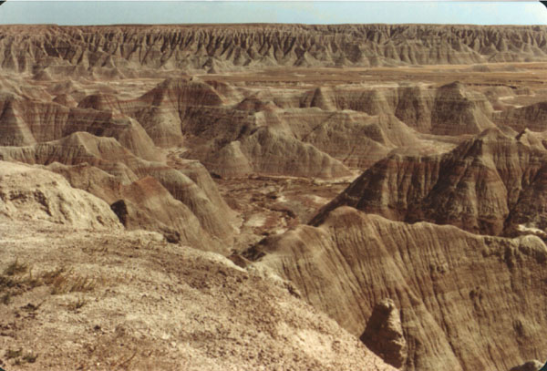
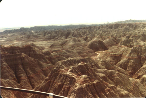
A typical view from a vantage point on one of the elevated areas of
the park. This is the stereotypical vision of what the badlands are. One
of the first recorded comments about this area said it was "a hell of a place
to lose a cow." The Badlands got their name, not because of their arid climate,
or lack of vegetation, but because the early travelers considered them difficult
to travel through, on horse, or by wagon. |
|
The entire park was formed by the effects of erosion. This area is
particularly susceptible to this process, because of the remarkably soft
materials of which the ground is made. This is called "mudstone" though it
is not really stone at all. It is essentially dried mud. Had the composition
of the sea bed been different, or had the sea been a bit longer lived, sandstone,
would have formed. Had the formations been covered, instead of uplifted,
metamorphic rocks may well have formed. |
|
The Badlands area is classified as semi-desert. During most of the
year, there is no rain at all. The few sporadic rains that come, are torrential.
After the rains, the area floods, and there are temporary rivers flowing
through the park. There is also a brief, but glorious bloom of plant life.
Total average rainfall for the year is 16 inches. |
|
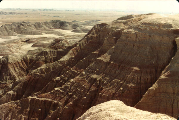
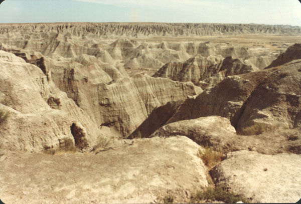
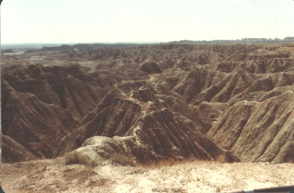
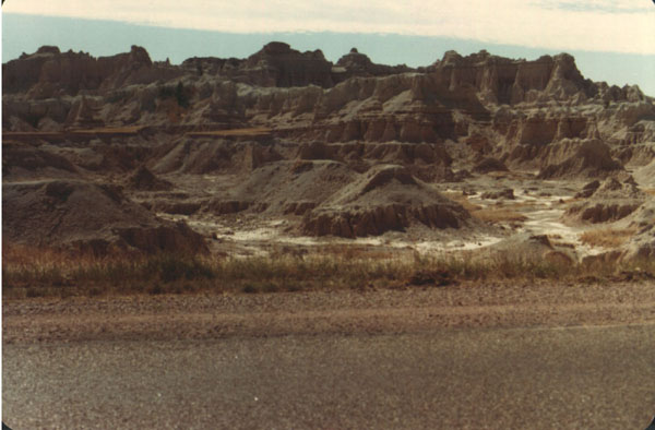
The effects of erosion are pretty clearly seen in all areas of the
park, but are especially apparent in areas like this. The view is from a
height at the edge of the park. In a less arid environment, the mudstone
would have been turned to soil, and been held in place by the local flora,
preventing the erosion, which. created these unique, and impressive features. |
|
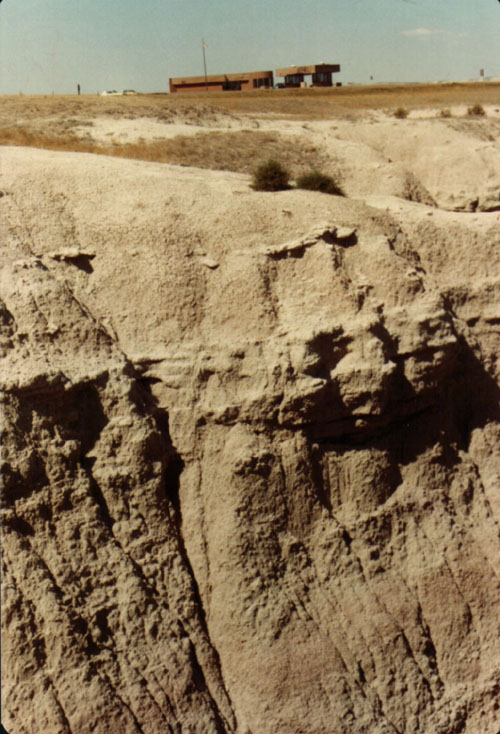
This is the main entrance to the park, as viewed from a neighboring
formation. The scale can be determined by realizing that you are looking
at a high ceilinged building holding a ranger station, gate, and administrative
center. The Badlands National Park, is one of our newer parks. It was only
designated as a park in 1973, after being preserved as a national monument
since the 1930's. |
|
It takes a very peculiar, and particular history to create large expanses
of mudstone, and a specific type of climate to turn it into Badlands. Add
to this the fact that, even when all conditions are right, these areas have
very short life spans, geologically speaking, and it can be inferred that
this is a very special place. |
|
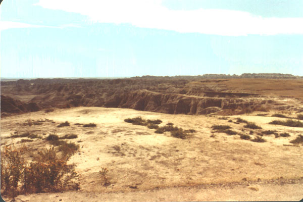
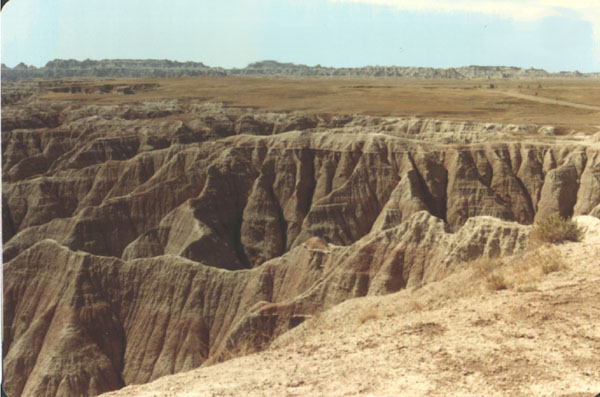
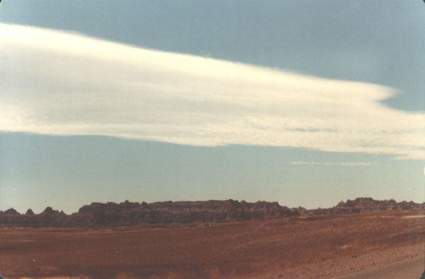
This is another shot from one of the boundary areas of the park. The
area I was standing in was still fairly flat, and rolled right into the
plain, being relatively uneroded. The whole edge of the park is like this,
with a sharp, sudden area of transition between plain, and Badlands. |
|
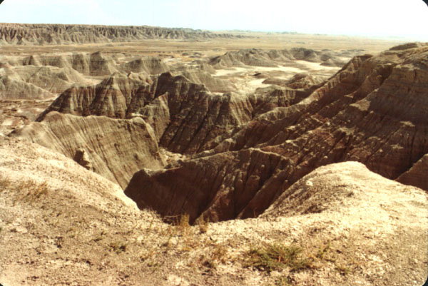
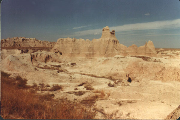
The beginnings of a new formation, and the mechanisms forming the
geology of the area, can be clearly seen in the lower right portion of this
photo. A small depression can be seen, from water runoff. In several hundred
years, this will have developed into one of the towering formations seen
off in the distance. |
|
Like the Black Hills, Devil's Tower, and Yellowstone Park itself,
the native Americans considered this area to be special, and to have power.
Though I do not share the religious beliefs of those first Americans, I certainly
can not argue with their opinion of these amazing places. There is an Indian
reservation in the southern part of the park. Unfortunately, this reservation
is the most impoverished place in the nation. A sad fate for a proud people. |
|
It is almost as if this ridge is asking to be walked along. I doubt
the park rangers would approve though. |
|
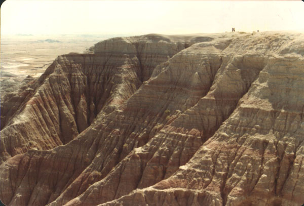
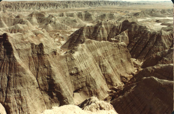
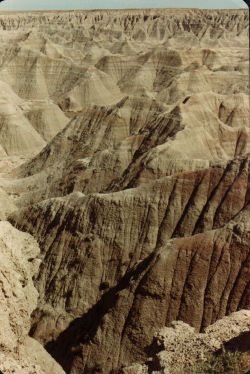
The layered, striations which make up the structure of the underlying
geology of the area, are particularly obvious in views like this. In the
distance, you can see the same colors and pattern on all of the separate
hills, and peaks. This whole area was once the bed of a great marsh, which
drained, dried, and was then uplifted. Thousands of years of erosional activity
have formed the fissures and rifts which draw so many tourists every year. |
|
The Badlands are growing every year, at the edges, even as they are
disappearing and flattening out on the interior. |
|
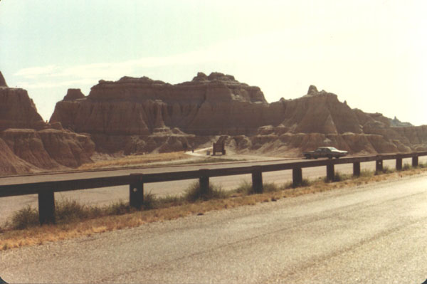
Roads, turn outs, scenic drives, and historical markers are found
through out the park. |
|
Towards the center of the park, the formations become smaller, and
less impressive. The very center of the area has become almost flat. These
are the oldest parts of the Badlands, and the most well worn. In some parts
of the park, the formations are worn away by as much as 2 feet a year. |
|
A single tall formation out in the middle of a somewhat flat area.
It reminded me of a castle, which is why I took this photo of it. . Unlike
the looming formations at the edge of the park, this one is only about 20-30
feet high. This photo was taken over twenty years ago, so this formation
is likely quite a bit smaller. It has probably shrunk down to the size of
one of the unremarkable rises in the foreground. |
|
These are some of the richest fossil beds in the world, for a variety
of reasons. Every year, the torrential rains bring forth a new crop. The
park has strict rules against any amateur collecting, or the removal of any
artifacts from the park. |